MOUNTAIN | Above The Clouds And Under The Stars
Return To Mt Timbac (Mt Singakalsa)
"You never climb the same mountain twice, not even in memory. Memory rebuilds the mountain, changes the weather, retells the jokes, remakes all the moves."
-- Lito Tejada-Flores
-- Lito Tejada-Flores

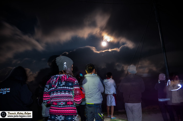
Above the sea of clouds and under the stars we were.
There was a moment when we all braved the cold and stepped outside just
to watch the heavenly moon hover the night sky, like a midnight sun
giving just enough illumination to the landscape. Its dark, the weather
is cold, but we felt the warmth of inspiration creeping in our hearts,
it was a site to behold, and so like paying homage to this beautiful
place, we stood in silence as the bright moon revealed itself behind the
passing clouds.
We all stepped out of our stone shelter to watch the moonshine together.
The wind is howling at 4 Degree
Celsius, the promise of sunshine and sea of clouds is dissolving by the
minute as we try to hide from the hustling wind, my sport jacket is
soaking wet and my jogging pants does very little to keep me warm.
Certainly these were not the fondest memories when I look back at my
first visit to Mt Timbac a year ago, yet I found myself looking back at
it after a few weeks while cursing the tropical summer heat in Metro
Manila. Nature was not our glad host for that day when I first went to
the summit of Mt Timbac, but the struggle and surviving the cold weather
that rivals that of Mt Pulag has left me a deep impression and utmost
respect to nature and the mountains.
Mt Timbac is one of the so called Two Thousander Mountains in the Philippines (elevated at Two Thousand Meters Above Sea Level) at 2,717+ MASL it is the 3rd in Luzon and the 9th Highest in the country, as neighbors of Mt Tabayoc and the famed Mt Pulag National Park temperatures can also drop drastically. This mountain is great for fun hike as its slopes had been tamed by farmers, so while it works as a safe haven for Philippine Mummy heritage, the vegetable paddies are all the way up near the summit providing a pathway clear of overhanging branches and view obstructing debris. While Mt Timbac does not offer the same outdoor challenge that it's pears have, it is still a mountain to be respected, sacred to the people who live here, this mountain is a personal favorite and one that will always be close to my heart.
I find it a rather sad thought, knowing well that Mt Timbac has succumbed to the changes brought by civilization and human intervention. As a Two Thousander this mountain pierces the clouds, so if Mt Pulag is famed for the Morning Sea of Clouds seen from its summit, it is also the same in here as the morning sun rises behind the imposing shadow of Mt Pulag. The downside is that instead of Pine and Mossy forest, you’ll find yourself walking in vegetable paddies, with farmer’s household scattering along the path. While the vegetable terraces is easy on the eyes, the height of this mountain is very much visible as you stand on the ravine edges and observe the miniature vehicles passing along Halsema Highway.
I find it a rather sad thought, knowing well that Mt Timbac has succumbed to the changes brought by civilization and human intervention. As a Two Thousander this mountain pierces the clouds, so if Mt Pulag is famed for the Morning Sea of Clouds seen from its summit, it is also the same in here as the morning sun rises behind the imposing shadow of Mt Pulag. The downside is that instead of Pine and Mossy forest, you’ll find yourself walking in vegetable paddies, with farmer’s household scattering along the path. While the vegetable terraces is easy on the eyes, the height of this mountain is very much visible as you stand on the ravine edges and observe the miniature vehicles passing along Halsema Highway.
A Sykes Outdoor Adopted School
In attendance before we depart, along with a few of the local children and students curious enough to check who their visitors were.
The same as my first visit, this is an outreach activity for Sykes Outdoor who had officially adopted Mangoto Elementary School, it means that every year we have to find our way back here to distribute school supplies for the students of the said school. It’s a perfect excuse to give more meaning to our meandering in this heritage site, promote a far meaningful appreciation of our rich cultural heritage, assist in the education of the future generation of Ibaloi's and other tribes living in this site.
Above The Clouds And Under The Stars
The Moon, low in the horizon, shining bright as the sun rises in the opposite side. I've never been to a place where you can watch the sunrise and moonset together in a rugged landscape.
Timed just a day after February Full Moon of 2014, it was a pleasant trip of finding my way back here after almost a year. The unfinished road is now complete that it allowed even for the van that we were in from Metro Manila to trek the steep road of Mt Timbac from the Halsema Highway to our stone shelter the Mangoto Elementary School. We arrived early evening, enjoying a clear sky with the rising moon above the rugged peaks of the Cordillera Landscape, I’ve never been to a more peaceful and visually stunning place even at night. The cold weather creeping in our thick jackets as we settled in preparing for our dinner, knowing in our hearts that the weather is perfect, the ancestors that have become legends in this place have bidden us welcome. After our dinner, it was enjoyable to huddle inside the classroom that served as our shelter for this cold night; after all, there were a lot of people who participated this year as compared to last year. New acquaintances all with kindred spirits and driven by wanderlust.
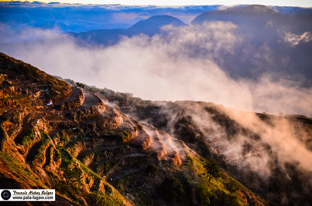
Waiting for the sun to greet us, the Sea of Clouds much closer than we can expect and a lot more breathtaking.
Trekking under the Full Moon it would take about an hour to trek the summit from our stone shelter the Mangoto Elementary School. Though most of us were tired, we really can’t sleep that much as we anticipate what lies ahead of us. The temperature kept dropping by the hour that at some time my extremities felt numb. Waking early, grabbing a sandwich and making sure we all have our headlamps and camera gadgets in tow; we head out in the pitch black night still illuminated by the moonshine. We walk past the paved road, to dirt pathways circling the side of the mountain, drawing closer the summit as light gathers, along vegetables paddies and burnt vegetation.
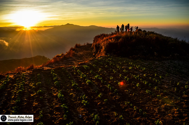
A burst of Sunlight behind the shadow of Mt Pulag and the Sea of Clouds before us.
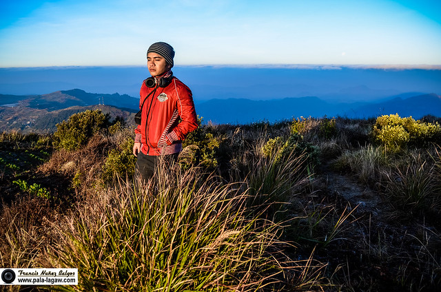
The moon, becoming more remote and distant every second that the Sun rises. A lone figure in a horizon bath in cold colors and the scenic Cordillera landscape.
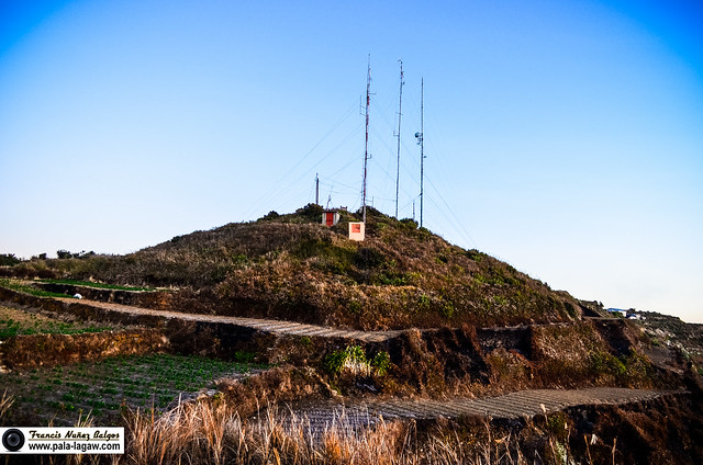
Mt Timbac main summit, as seen from it's 2nd summit.
The landscape of Gattubo, Atok, Benguet slowly awakens, revealing the Halsema Highway where the marker for the "Highest Point of the Philippine Highway System" is located.
Soaking up the warmth of early Morning Sun up in the mountain. It had been a cold night after all.
Before me is the Geodetic Control Point (GCP) marking the highest point in Mt Timbac.
Mt Timbac as shown on the map and its distance from Kabayan, Benguet and the more popular neighbor Mt Pulag. I place a circle in the Timbac Mummy caves.
The landscape of Gattubo, Atok, Benguet slowly awakens, revealing the Halsema Highway where the marker for the "Highest Point of the Philippine Highway System" is located.
Soaking up the warmth of early Morning Sun up in the mountain. It had been a cold night after all.
Before me is the Geodetic Control Point (GCP) marking the highest point in Mt Timbac.
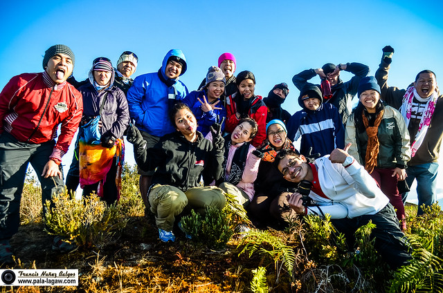
Hiking with kindred souls and positive disposition. This is us soaking up the sun and making faces for the camera.
Jelly didn't want a picture of her in the grotto, but she was curious enough to take a peak as I take a snap of the camera.
On our way down, these local kids where very friendly.
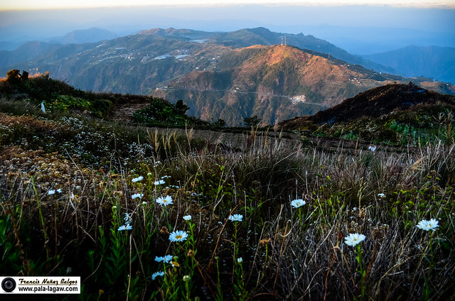
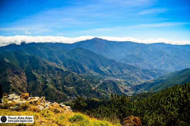
The rugged landscape of Benguet, in here is where you can behold Luzon's highest peak Mt Pulag, the side of which Aikiki Trail is hiked.
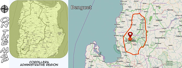
On The Map
On a closer look.
Mt Singakalsa is an a.k.a of Mt Timbac, a closer look on the map will
show the Timbac Mummy Caves along the hills facing the town of Kabayan.
The snaking green mark is the Halsema Highway along Atok, Benguet while
the straight green lines is the Upper Agno River Basin.
Francis Balgos
is a Call Center Agent, Weekend Travel Warrior, Amateur Spelunker,
Sometime Surfer, Newbie Mountain Climber, Photography Enthusiast,
Certified Beach Bum, A first born son, Faithful lover, True Explorer...
Follow Me
All Rights Reserved
Pala-lagaw reserves the right for any watermarked pictures posted
No pictures should be downloaded or copied without permission from the blogger.










Awesome view!
ReplyDeleteSalamat sa pag bisita Sir Mina! :)
ReplyDeleteAng ganda! Napakaromantic yong unang picture!
ReplyDeleteI feel the same way too..
Deletekaya I use that as the promotional and first photo,
though it should be in the middle. :)
Captivating photos and words. Im inspired to go up...
ReplyDeleteThanks Jherson! :)
Delete